Over the weekend we had the notion to travel Mullan Pass just west of Helena.
It was a nice sunny afternoon with temps in the upper 70’s to low 80’s.
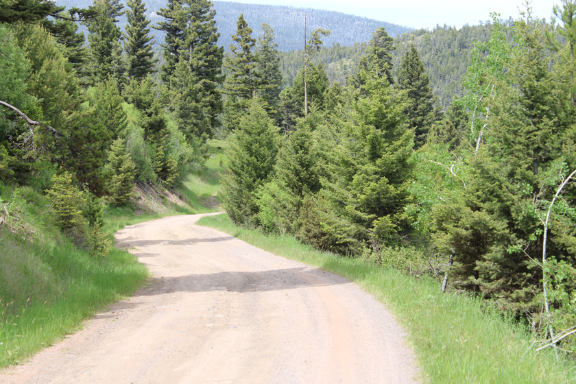
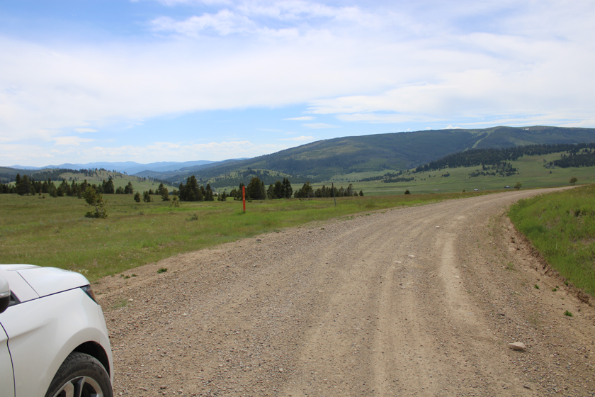
We started out at the bottom along Austin Creek on the east side but had to turn around because of poor road conditions. Though it was dry, the road had various enormous huge ruts that might have been better suited to navigation if we had brought the truck.
 We decided to go around over McDonald Pass and pick up the Mullan Road from the west side. The road on that side was much more suited for SUV travel.
There was quite a bit of traffic on the west side, with Quads, ATV’s, and other SUV’s stirring up the dust, along with mountain bikers all decked out in their Italian bicycle pants and back packs.
When we got to the top, we decided to travel down the other side heading east but had to turn around after about 500 yards due to the poor road conditions that our 4×4 truck could have easily handled if we had taken it instead of our SUV.
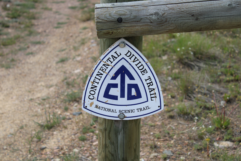
 The original historical placard marking the top of the pass was gone. The only thing that indicated we were at the top of the pass was a Continental Divide Trail marker, and of course, the grade that headed downhill from that point.
Heading north on Blossburg Road from the point of Mullan’s Pass would have taken us 9 miles, traveling between Round Top Mountain and Bald Butte to Marysville.
The adventure was a good one over all. Looking up and down the road, one could just somehow imaging trains of wagons and lines of Calvary with all of their respective settlers, freight, and military supplies, heading west, passing along in the warmer weather months.
 I can imagine that the road itself was in much better shape back in the day because it was usually those who traveled the road that kept it maintained.
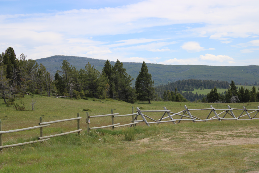
These days though, it’s all pretty much private property on each side and any regular maintenance is done by the respective property owners and only on very rare occasion.
The railroad, to a certain extent might provide at least some of the maintenance on the west side because it has a materials yard, a short railroad spur line, and a shop located right at the west entrance to the tunnel.
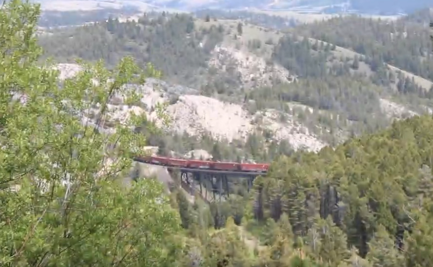
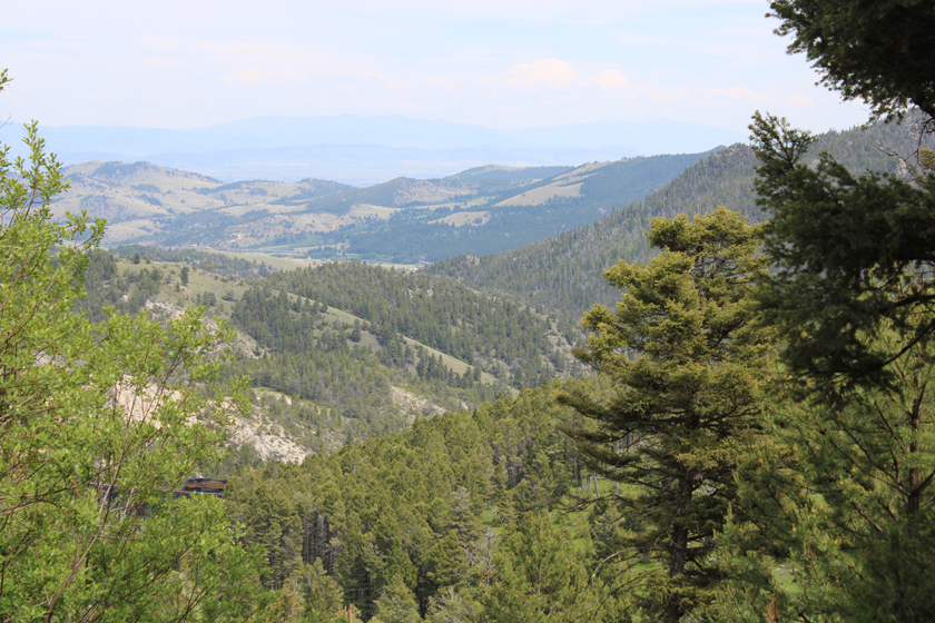
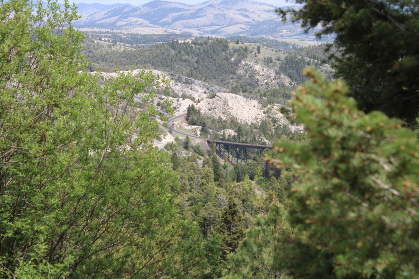
 The railroad dominates Mullan Pass these days, with winding bridges and a tunnel. This was the first main line transcontinental route for the Northern Pacific Railway, which opened in 1883, connecting Minnesota to the Puget Sound area.
The tunnel is 330 feet lower than the top of the pass, and is the longest rail tunnel in Montana, even though it was shortened by 400 feet in 2009 (to 3,426 feet).
When the railroad tunnel was originally built in 1883, it was less than 13 feet wide, which provided less than three inches of room (to spare) for some loads. Work done in 2009 widened it by three feet, and increased its height by 5 feet, allowing more air in the tunnel, which helps to keep the high horsepower helper engines from overheating.
The rail line is pretty heavily used. When we were there, we had the opportunity from down below, to watch 5 helper engines cross over the high trestle at Austin Creek, and a rather long train come up the Little Blackfoot River valley from the west and we watched it cross the trestle at Austin Creek from up above.
I think the next time we visit Mullan’s Pass we’ll bring our 4×4 truck so we can do more exploring in that area.
As is always the case, it’s always a great day in Montana when you can walk the trails or drive the roads that our Montana forefathers built way back in the day.
After our Mullan’s Pass adventure, we headed on over to Parkers Restaurant in Drummond for one of Brent’s famous Double Bacon Cheeseburgers.
Captain Mullan and His Road:
The pass was named after Lieutenant John Mullan, the U.S. Army engineer who first crossed the pass on March 22, 1854, and later supervised construction of the Mullan Road, the first road over the pass, in 1860.
Coming in from the west, the Mullan Road continued along the present route through Missoula and along the Clark Fork River (interstate 90) to a point a few miles north of the present town of Deer Lodge at Garrison. Then, bearing northeast (US HWY 12), it ascended the Little Blackfoot River to cross the Continental Divide of the Rocky Mountains at Mullan’s Pass. The road then went down along Little Prickly Pear Creek to near the Missouri River, straight north and across the Dearborn River (interstate 15), northeast past Bird Tail Rock and across the Sun River.
By modern standards it wasn’t much of a road, but in 1862 it was a key to progress. Specifications called for it to be 25 feet wide, graded to permit wagon passage and with the necessary stream crossings, be they fords, bridges, or ferries.
Gallery:
Notes:
Learn more about Lieutenant John Mullan and his road: https://www.historylink.org/File/9202
Footnote:
… on the mountain bikers all decked out in their Italian bicycle pants and back packs.
None of them had bear spray and insisted that soft sided camping was safe. They determined that they would be safe from the bears by making sure to place their food (primarily oatmeal) at least 100 feet away from their tents at night thinking that the bears would be more interested in that instead of them.
I reminded them that regardless of the oatmeal they were still considered food by a Grizzly.
I reminded them of the 65 year old mountain biker that was killed by a Grizzly a few years back (2021) while she was sleeping in her tent near the Ovando, Montana post office, and that I didn’t want to be reading about them in the news the following day, and to stay safe in their travels on the mountain roads.


[…] after tooling around in the woods over on Mullan’s Pass, we discovered that we hadn’t even had lunch, so we decided to head over to Parker’s […]