It looks like we might be in for a soaker on Monday and Tuesday this coming week.
The first day of Summer is next Thursday and it looks as if Spring still sort of wants to hang on for a bit.
A Pacific trough and a cold front will be moving into Montana on Saturday.
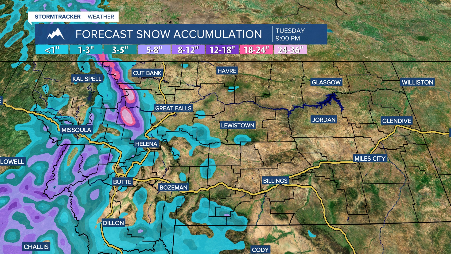
A WINTER STORM WATCH has been issued for a lot of the mountains in Montana for Monday and Tuesday. Up to 5″ of snow is possible at pass level and up to 20″ of snow is possible in the mountains, including in Glacier National Park. A little bit of snow accumulation is also possible this weekend as the front begins to move through.
According to the National Weather Service:
Tuesday – Rain likely. Mostly cloudy, with a high near 54.
Tuesday night – A chance of rain. Mostly cloudy, with a low around 39.
Local showers may stick around after Tuesday, but temps will improve during the day.
Wednesday – A slight chance of rain. Mostly sunny, with a high near 65.
Wednesday night – A slight chance of rain. Partly cloudy, with a low around 41.
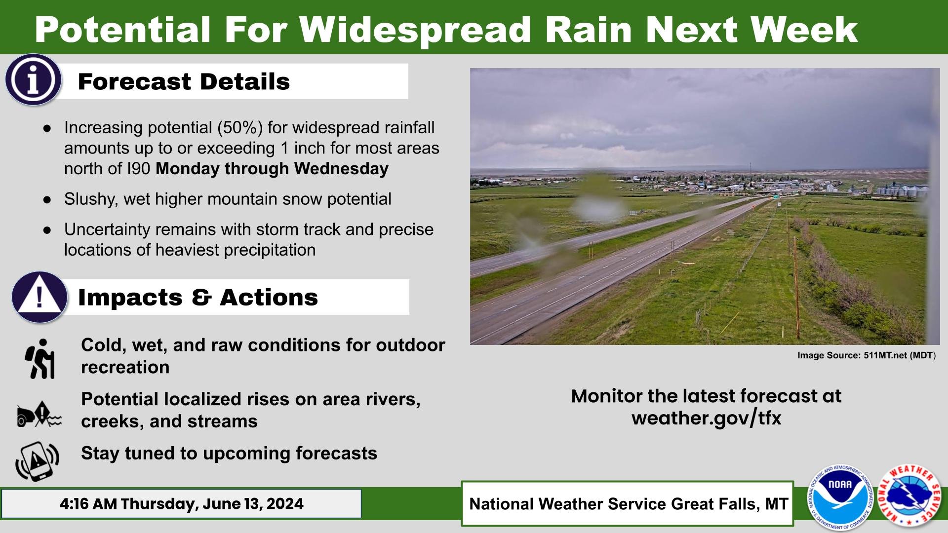
For those of us that won’t be getting any snow, the National Weather Service in Great Falls had this to say:
Increasing potential (50%) for widespread rainfall amounts up to or exceeding 1 inch for most areas north of I-90 Monday through Wednesday.
Snow levels will be around 6,000 feet by Sunday night, but these may lower further down to 5,000 feet. Winter Storm Watches will be in effect starting Monday evening for the mountains along the divide and in southwest Montana where 4-14″+ appear possible.
The National Weather Service advises:
Be prepared for raw backcountry conditions during this time period.


